Street closures around MUHC sites this weekend
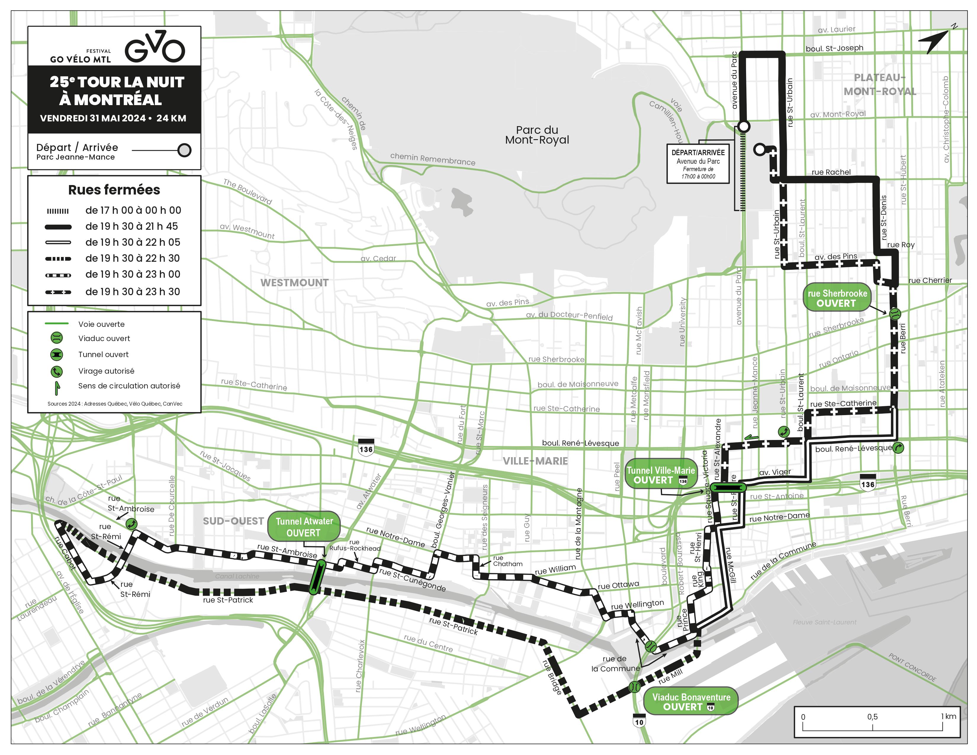
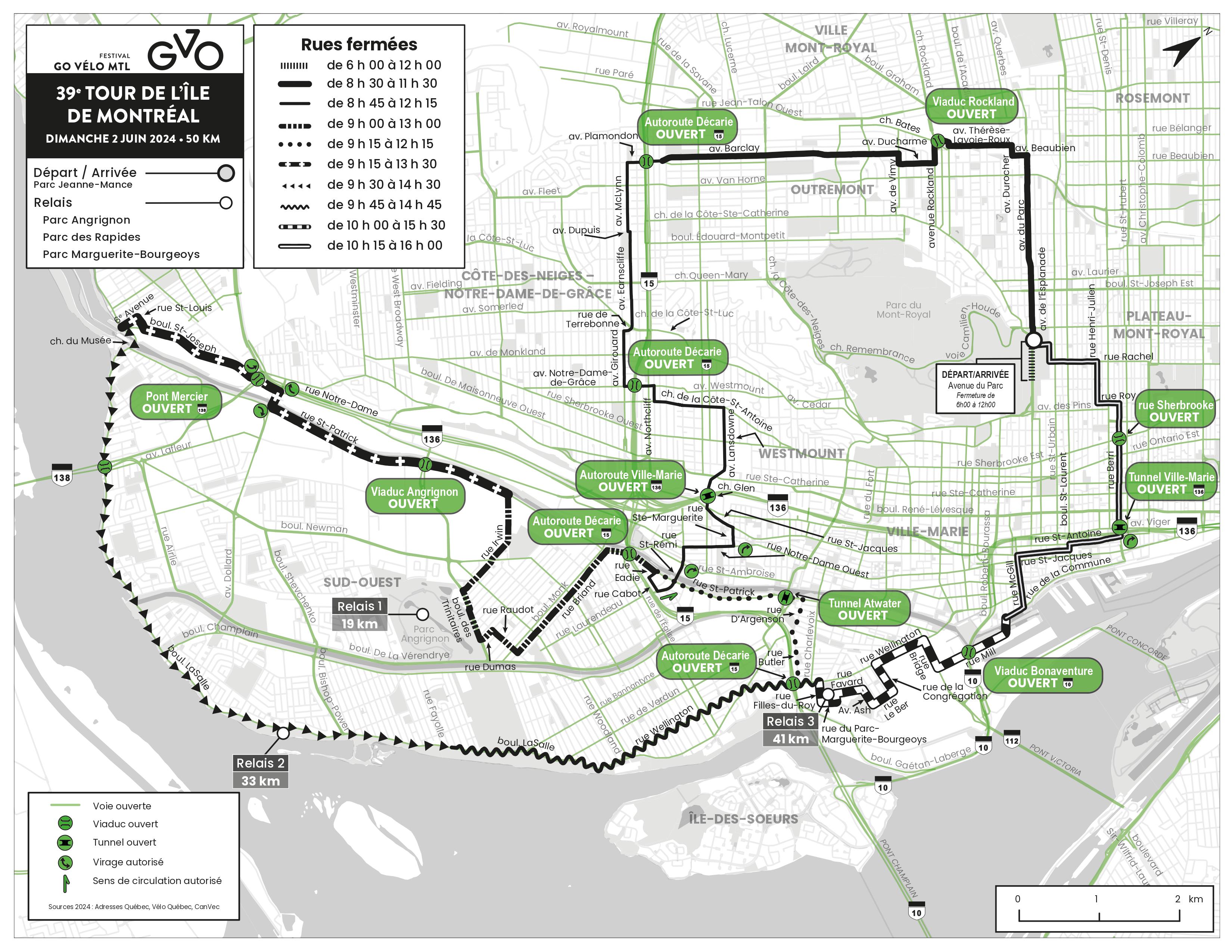
Please note that during the Festival Go Vélo (Tour de l’île), many street closures around MUHC hospitals are expected (Glen site, the MGH and the Neuro). To ensure round-the-clock access to emergency services, Urgences-santé has identified several bridges for emergency purposes.
Dates:
-
Tour de Nuit — Friday, May 31
-
Tour de l’Île — Sunday, June 2
Please consult one of the following sites to plan your route this weekend:
-
Google Map Tour la Nuit (May 31)
-
Waze Map Circulation Tour la Nuit (May 31)
-
Google Map Tour de l’Île (June 2)
-
Waze Map Circulation Tour de l’Île (June 2)
You can use the Google Maps app to plan ahead, or on the day of the event itself, use the Waze app. Waze provides you with the best route to take in real-time, with live traffic updates.
Finally, you can visit Infocirculation Vélo Québec for all details.
(Extra description) The night tour route (Friday) starts on avenue du Parc, goes south on the Berri, then through downtown to the southwest (Saint-Henri and Saint-Patrick to the east) up Berri to Parc/Mont-Royal, and does not interfere with access to our sites.

The daytime route (Sunday) starts on avenue du Parc, near rue Mont-Royal, climbs to Outremont, then heads west to descend south into Notre-Dame-De-Grâce passes near the Glen Campus and continues southwest (Saint-Patrick) to 6th avenue west, back east on boul. Lasalle and eventually up Berri Street to end in the park north of Mont-Royal. This zone encloses several of our sites, including the Montreal General Hospital and the Montreal Neurological Hospital, as illustrated on the attached map. Automobile access points are indicated.

